| |

Advantages and Disadvantages of Remote SensingThe study of gathering data about an object or phenomena without directly coming into touch with it is known as remote sensing. In other words, it is the process of identifying and assessing an object's or phenomenon's qualities from a distance. Active and passive remote sensing are the two primary categories. In active remote sensing, the target is illuminated with an energy source (often electromagnetic radiation), and the reflected energy is then measured. On the other hand, passive remote sensing uses the object itself as a source of energy (usually thermal radiation). 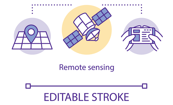
Remote sensing has a wide range of uses, including tracking crops, geological mapping features, and researching the dynamics of the Earth's atmosphere and climate. Satellites, aircraft, drones, and even balloons are some of the platforms that may collect data using remote sensing. The chosen platform is determined by the particular application and the needed data qualities (e.g., spatial resolution, temporal resolution, spectral resolution). The most popular platform for remote sensing is a satellite since it can cover a large region and be fitted with a number of sensors. Aircraft and drones are frequently employed for more specialized tasks, including examining a particular catastrophe site or agricultural sector. Sometimes, balloons are employed for studying the atmosphere. There are many pros and cons of using remote sensing. In this article, we will discuss about few advantages and disadvantages of using Remote Sensing. Advantages of Remote SensingMonitor Large Areas In order to monitor and scan broad regions, remote sensing is a significant asset. The term "remote sensing" describes the process of gathering knowledge about a subject or space from a distance, typically via a crewless aerial vehicle, satellite, or aeroplane. Remote sensing enables the rapid and precise measurement of a wide range of physical properties over huge geographic regions, including topography and soil moisture. With the use of remote sensing, scientists may also map and keep track of environmental factors such as vegetation, water supplies, changes in urban land use, ocean surface temperatures, and more. Remote sensing may be used to identify potentially unsafe regions or environmental changes in addition to giving comprehensive information on vast areas. It may be used, for instance, to find forest fires and monitor changes in the way land is used in a certain area. Along with observing changes in agricultural techniques, it may also be used to track changes in animal populations through time. Therefore, remote sensing is an effective tool for managing and monitoring the environment across vast regions. Used in Real-Time Data from real-time remote sensing can be utilized to make judgments in close to real-time. This can be very useful for monitoring natural catastrophes or reacting to shifting environmental circumstances. For instance, remote sensing can be used to track the development of a storm, wildfire, or oil spill. Real-time remote sensing can offer up-to-date knowledge about the magnitude, location, and effects of an event on the environment, depending on the frequency of data capture. This can help rescue personnel and other staff members to plan and complete their response tasks more successfully. Furthermore, as a catastrophe event unfolds, real-time remote sensing can assist in identifying regions that require evacuation. Real-time data may be used to locate potentially dangerous places in the event of a wildfire. Time-Saving Compared to conventional techniques of land surveying, remote sensing offers cost and time reductions. Surveyors are able to swiftly and precisely collect enormous volumes of data by employing satellites and flying devices. This enables a significantly quicker turnaround time and lower cost, both in terms of labour and materials. Data analysis is more effective since the data is also digitalized and easily accessible. The end result of all this is shortened project schedules and reduced costs, which are two major benefits of remote sensing. The use of computerized aerial photogrammetry, which provides a quick and reasonably priced means to assess topography or plan projects like pipelines and roads, is one example of cost reductions. Repeated Use of Data The results of remote sensing can be utilized in many ways. So, the acquired data may be saved in databases for later use because it is digital in nature. It follows that the same information can be employed again for various goals. For instance, in numerous academic subjects, including urban planning, environmental sciences, agricultural sciences, and disaster management, a remote sensing image captured at a certain moment may be utilized for multiple objectives. The data may also be used to track changes in land cover over time, identify environmental patterns, and evaluate the effects of human activity on land cover. Accuracy One of the main benefits of remote sensing is accuracy. It refers to how accurate or precise a measurement's outcome is. When outcomes are more accurate, the data obtained is more likely to be trustworthy, resulting in more accurate and valid assumptions, forecasts, or research. Remote sensing is able to measure and forecast changes in land cover precisely. Researchers can make more precise findings about environmental changes by gathering data from vast large areas of land or water. Since remote sensing uses contemporary technology to track changes over time automatically, it also offers a greater accuracy rate than conventional survey methods. Understanding the complicated connections between Earth's atmosphere, hydrosphere, biosphere, and lithosphere is made much easier because of the accuracy of remote sensing. Consequences of Remote SensingMisuse of Natural Resources Incorrect usage of natural resources is a drawback of remote sensing. This is because of the development of satellite technology. Governments and corporations may now benefit from large-scale and widespread remote sensing to gather important data that can be utilized to identify the natural resources that are present in certain locations. Then, without taking into account the effects on the environment or any possible risks, this may be utilized to exploit these resources. For instance, improper wood harvesting methods employing remote sensing techniques might significantly deplete a region's resources if the consequences on the local environment are not carefully taken into account. In addition, resource exploitation that is enhanced as a result of remote sensing may have long-term negative effects on the ecosystem, including an increase in erosion, desertification, and water contamination. Invasion of Privacy Remote sensing has the drawback of invading people's privacy since the technology may be used to track activities and gather data on people without their knowledge or agreement. With the use of remote sensing technology, pictures and photos may be taken from very high-altitude satellites or aeroplanes, which are able to record pictures in a lot more detail than ground-based cameras. In addition to studying traffic patterns and identifying people, this technique may also be used to gauge a building's scale. Recent legal disputes involving the Fourth Amendment of the United States Constitution (right to privacy), as well as several international treaties that forbid unjustified interference in people's lives, have focused on the possible invasion of privacy produced by these remote sensors. The commercialization of the remote sensing field, in which businesses buy and sell vast amounts of images and data, which can include information on people's movements, has made this problem more challenging. Security Implications The security implications of remote sensing are one of its main drawbacks. Because the information acquired is frequently not encrypted or protected, it is susceptible to theft and misuse, which can pose serious security issues. This is so that data from the environment may be gathered using various techniques such as electromagnetic radiation, recorded photographs, and sound waves. Additionally, if the sensors are positioned in specific areas, they could be able to gather private data such as bank records, personal information, government databases, and even military communications. Then, this private information can be sold to rivals or enemies, or it can be used for other evil purposes. Unfortunately, because the technology is still in its development, there are sometimes little or no safety standards. As a result, anybody with access to the sensors may see the information collected without authorization, further risking security. Expensive Remote sensing's high cost is one of its main drawbacks. In order to acquire data for remote sensing, you need pricey equipment. The price of these devices can range from hundreds to millions of dollars. Additionally, expensive satellites and specialized aircraft must be launched in order to collect remote sensing data. Because of this, gathering remote sensing data is too expensive for many businesses and people. Due to the difficulty in comprehending the data, processing and analyzing the data are also expensive. Companies must also spend money on gear and software to process the photos taken by remote sensing tools. Time and money spent on this may be better spent on other things. In general, remote sensing's high prices are a key drawback since they frequently make it unaffordable for many individuals and organizations. As a result, only substantial businesses with the required financial means can afford to employ this strategy. ConclusionDespite certain drawbacks, remote sensing offers significantly more advantages than drawbacks. By enabling us to perceive things that are sometimes unseen by human sight, remote sensing has completely changed the way we view the world. Scientists have a great tool for gathering data, comprehending processes, and keeping track of change thanks to the accuracy and precision of remote sensing data. This technique may be used to map land usage, monitor plant growth, follow the routes of catastrophic storms and other natural catastrophes, and monitor deforestation and agriculture. Our perception and comprehension of the world have been fundamentally altered by the strong instrument of remote sensing. |
 For Videos Join Our Youtube Channel: Join Now
Feedback
- Send your Feedback to [email protected]
Help Others, Please Share


